Condition Report
Contact Information
Lot 89
CARY, John (ca 1754-1835)
Sale 503 - Fine Books and Manuscripts
Sep 13, 2017
9:59AM
Live / 1338 West Lake Street
Own a similar item?
Estimate
$3,000 -
5,000
Price Realized
$2,750
Sold prices are inclusive of Buyer’s Premium
Lot Description
CARY, John (ca 1754-1835)
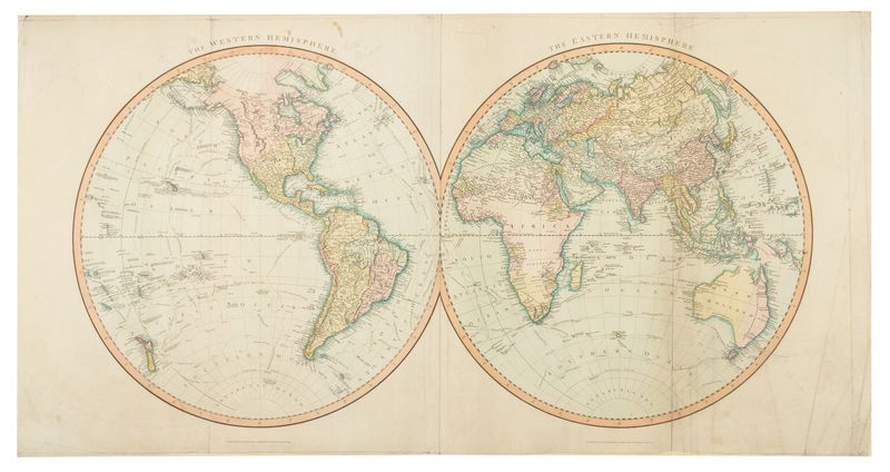
Cary's New Universal Atlas, containing distinct maps of all the Principal States and Kingdoms throughout the World. London: for J. Cary, 1808.Oblong folio (552 x 680 mm). 54 hand-colored engraved maps, including 4 folding maps and 2 maps printed on two sheets (Scotland and South America). (A few pale spots, title-page and maps laid down, lacking the list of maps, usually pasted to the inside front cover.) Modern red half morocco. Cary's atlas includes a double-hemisphere world map, a Mercator projection world map, and numerous maps relating to Europe, Asia, the Americas, and Africa. The maps of North America show early westward expansion toward the Mississippi River. Bounty Land Grants for the Illinois and Wabash Companies are named near the Illinois and Wabash Rivers. They include information on portages, roads, fords, settlements and topography. Phillips Atlases 714.

