Condition Report
Contact Information
Lot 81
SENEX, John (ca.1678-1640)
Sale 503 - Fine Books and Manuscripts
Sep 13, 2017
9:59AM
Live / 1338 West Lake Street
Own a similar item?
Estimate
$300 -
500
Lot Description
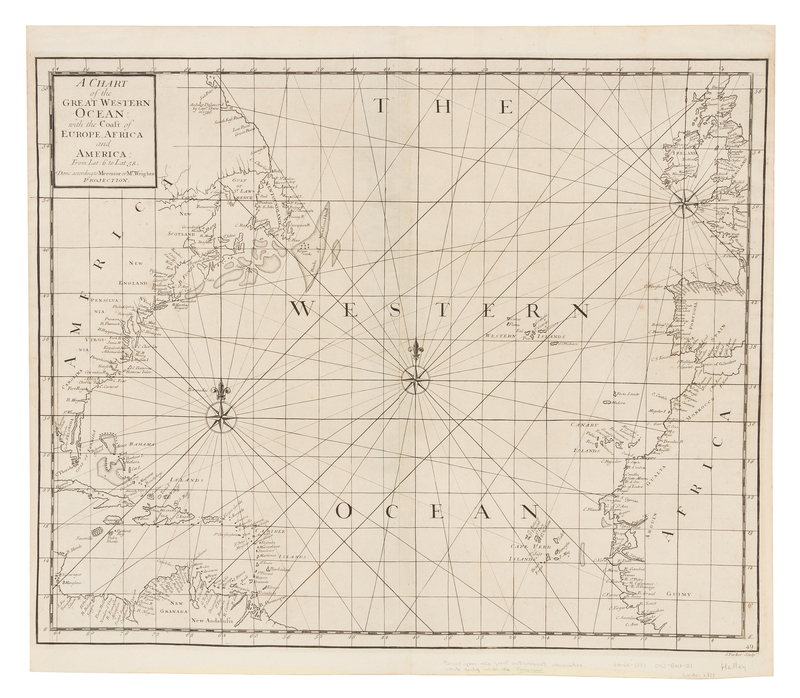
SENEX, John (ca.1678-1640)
A Chart of the Great Western Ocean: with the Coast of Europe, Africa and America: from Lat: 6 to Lat 58. [London: n.p., 1728].Engraved sea chart of the north Atlantic Ocean depicting the coasts of North and Central America, Western Europe, and North Africa, image 494 x 600 mm (542 x 620 mm sheet). Compass roses, rhumb lines. FIRST ISSUE of this chart based on Edward Halley's observations while sailing with the Paramour.