Condition Report
Contact Information
Lot 41
MOLL, Herman (1654-1732)
Sale 503 - Fine Books and Manuscripts
Sep 13, 2017
9:59AM
Live / 1338 West Lake Street
Own a similar item?
Estimate
$300 -
400
Price Realized
$238
Sold prices are inclusive of Buyer’s Premium
Lot Description
MOLL, Herman (1654-1732)
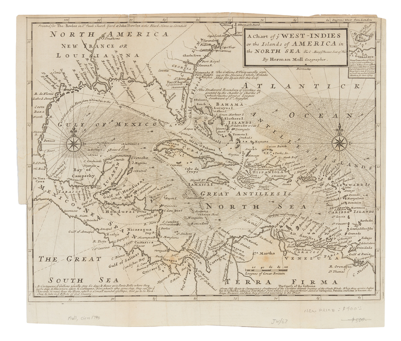
A Chart of ye West-Indies or the Islands of America in the North Sea &c. London: for Thomas and John Bowles, ca 1740.Engraved folding map of the Golf of Mexico and the Carribbean, image 284 x 352 mm (312 x 368 mm sheet). Inset map of Vera Cruz, compass roses. (A few short tears crossing image repaired on verso, tiny hole to fold.) Includes comments on the movement of Spanish galleons around the region, and depicts the present-day southeastern United States, Central America, and the Carribbean.

